Professional Route Surveys for Roads, Pipelines, and Utilities in Kenya
When planning linear infrastructure projects such as roads, pipelines, or utility corridors, accurate route surveys are the foundation of success. At Bridgepoint Engineers Limited, we specialize in delivering precise, NCA-compliant survey data that empowers developers, contractors, and government agencies to make informed decisions. Whether you are laying a water pipeline in Nairobi or constructing a road in Kisumu, our team ensures your project starts on solid ground.
Why Route Surveys Matter for Your Project
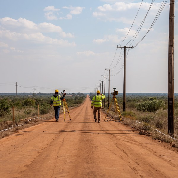
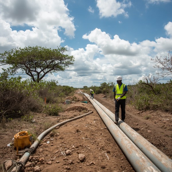
A route survey is more than just mapping a path; it involves detailed topographic analysis, geospatial data collection, and environmental consideration. For roads, the survey defines alignment, curves, and drainage needs. For pipelines, it identifies optimal burial depth, potential obstacles, and elevation changes. For utilities like power lines or fiber optics, it ensures clearance from existing structures. Our surveys integrate with Construction Site Setting Out and Project Control Kenya services, providing a seamless transition from design to physical construction.
Our Approach to Route Surveys
Advanced Technology for Accurate Data
We use GNSS receivers, total stations, and drone-based LiDAR to capture high-resolution data. This allows us to produce contour maps, cross-sections, and digital terrain models with centimeter-level accuracy. Our team in Nairobi deploys these tools across Kenya, ensuring even remote routes are surveyed efficiently.
Integrating with Project Control
A route survey is the first step in Construction Project Management Kenya. The data we collect feeds directly into project scheduling, cost estimation, and risk assessment. By identifying constraints early, we help you avoid costly redesigns. Our Project control consultants Kenya use the survey to establish control points that guide every subsequent construction activity.
Key Services We Offer
Road Route Surveys
From national highways to rural access roads, our surveys support design and construction. We provide centerline staking, cross-sections, and volume calculations. Our Civil engineering surveying Kenya expertise ensures alignment with road authority standards. We also offer Building demarcation services Mombasa and other regions for projects near road corridors.
Pipeline Route Surveys
For water, oil, or gas pipelines, our surveys map the corridor in detail. We identify soil types, existing utilities, and environmental features. This data is critical for hydraulic design and installation planning. Our Land surveying for construction Kenya includes utility location services to prevent conflicts.
Utility Route Surveys
Telecommunications, power lines, and fiber optics require precise route planning. Our surveys determine the best alignment considering topography, vegetation, and property boundaries. We also provide Site setting out services Nairobi for pole placement and trench digging.
Comprehensive Construction Support
Our route surveys are part of a larger suite of services. After the survey, we offer Surveyors for building layout Kenya to transfer design coordinates to the ground. Our Site supervision and control Kisumu team monitors construction against the survey plan, ensuring compliance. We also provide Project scheduling and monitoring Kenya to keep your project on track. With Construction cost control services Nairobi, we help you manage expenses by providing accurate quantity take-offs from survey data.
Why Choose Bridgepoint Engineers Limited?
- NCA Compliance: All our surveys meet National Construction Authority requirements, ensuring your project passes regulatory scrutiny.
- Local Expertise: We understand Kenya's terrain, from Nairobi's urban grid to rural landscapes. Our team is familiar with regional challenges like weather, land ownership, and access.
- Integrated Approach: We combine surveying with project control, site supervision, and cost management. This holistic view reduces risks and enhances efficiency.
- Technology-Driven: We invest in the latest equipment and software to deliver faster, more accurate results.
- Commitment to Quality: Our team is led by licensed surveyors and engineers who prioritize precision and client satisfaction.
Our Process
Step 1: Consultation and Scope Definition
We discuss your project goals, timeline, and budget. We identify the corridor, data requirements, and deliverables. This includes understanding any environmental or social constraints.
Step 2: Fieldwork and Data Collection
Our surveyors mobilize to the site. We establish control points and collect topographic, utility, and property data. We use a combination of ground-based and aerial methods for comprehensive coverage.
Step 3: Data Processing and Analysis
Back in the office, we process the raw data into usable formats: maps, cross-sections, volume reports, and digital models. Our engineers review for accuracy and consistency.
Step 4: Deliverables and Support
You receive a complete survey package, including reports and CAD files. We remain available for questions and can provide on-site support during construction for set-out and verification.
Frequently Asked Questions
What is the typical timeline for a route survey?
Timelines depend on corridor length and complexity. A 10-km road survey can take 1-2 weeks for fieldwork, plus processing. We provide a schedule during consultation.
Do you offer surveys for small-scale projects?
Yes, we handle projects of all sizes. From a 1-km pipeline to a 100-km road, our team tailors the approach to your needs. Contact us for a quote.
How does your survey integrate with construction?
Our surveys include setting control points that guide construction set-out. We provide stakeout data for road alignment, pipeline trenching, and utility installations.
Are your services NCA compliant?
Absolutely. We adhere to NCA standards and provide certification documents for regulatory approvals. Our team is registered and insured.
Ready to start your route survey? Contact Bridgepoint Engineers Limited today for a consultation and quote. Let us provide the precision your project needs.
Frequently Asked Questions
What is the typical timeline for a route survey?
Timelines depend on corridor length and complexity. A 10-km road survey can take 1-2 weeks for fieldwork, plus processing. We provide a schedule during consultation.
Do you offer surveys for small-scale projects?
Yes, we handle projects of all sizes. From a 1-km pipeline to a 100-km road, our team tailors the approach to your needs. Contact us for a quote.